


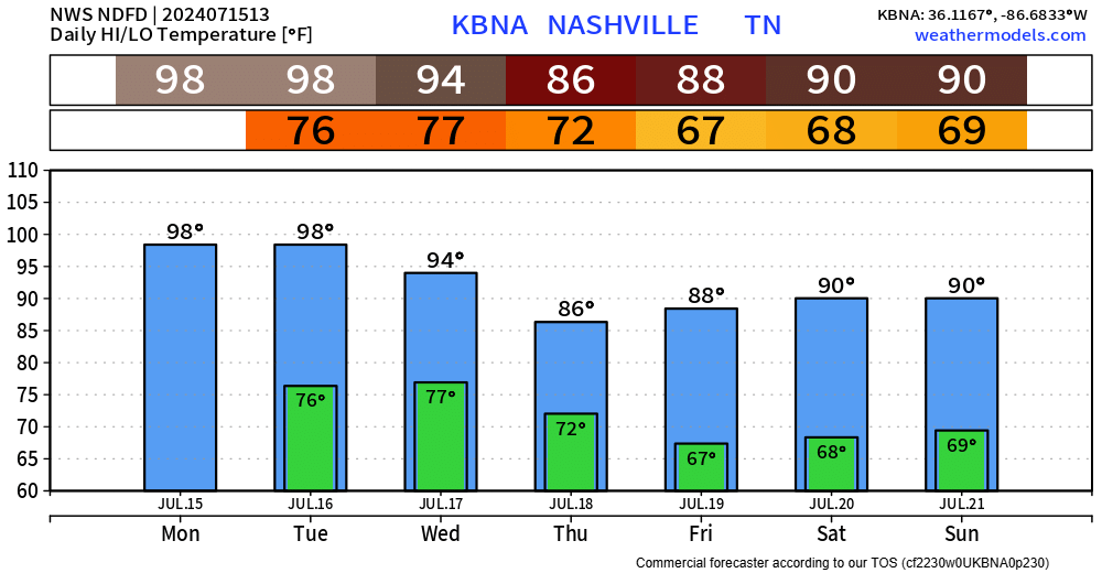
We did end up getting to 100° yesterday at BNA, fingers crossed we don’t repeat that today and tomorrow.
“…the last time we reached 100 two days in a row (at BNA) was just last year on August 24 and 25. If we get there today and tomorrow, that would be 3 days in a row. The last time we did that, we did it twice in one year: July and August 1990.” – NWS Nashville
Dewpoints will creep up into the upper 60s/low 70s today and will continue into tomorrow, which will make it a bit more challenging to make it to 100°. Regardless of if we make it or not, temperatures will be hot. If you must be outside today, be sure to take plenty of breaks in the shade or A/C and stay hydrated. Heat exhaustion can creep up quick.
Low afternoon + evening Wattery chances exist today and tomorrow. Most of us will stay dry, but a few lucky ones may see a shower/lightningstorm to cool us off.
The HRRR model thinks most of the activity stays off to our east today…
…and shows better chances for Tuesday – especially for folks south of I-40.
If thunder roars, go indoors. No severe weather expected, but heavy rain, lightning, and maybe some gusty winds possible.
A cold front makes it here sometime Wednesday PM, bringing us some decent rainfall and a break from the hot temps.
No severe weather expected, but a few storms could be on the stronger side with some gusty winds.
The cold front is expected to slow down and hang around just to our south as we wrap up the week. It’ll be just close enough to bring daily rain chances thru the weekend.
Rainfall totals thru early next week currently around 1 – 2″. Grass and gardens celebrate.
 Log In To Facebook To Comment