
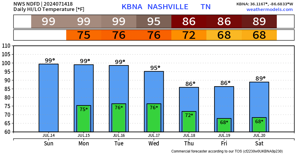
The next 3 days will pretty much be a rinse and repeat, but hopefully we actually get rinsed by some rain.
Today, Monday and Tuesday all carry the chance of reaching the 100° mark, but regardless of upper 90s or the century mark – it’ll be hot.
Dewpoints in the low 60s today will tick up for Monday and Tuesday, potentially getting into the low 70s.
That combination of heat + humidity Mon. + Tues. may send heat index values above 105°.

However, each day will carry the chance of an isolated shower/storm to cool us off.
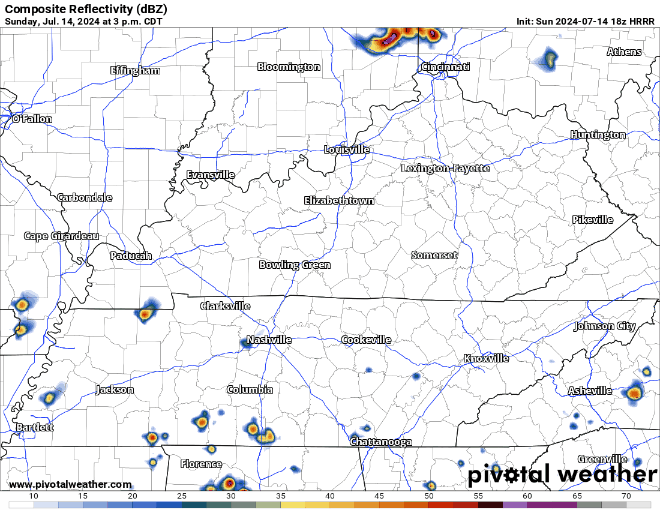
The HRRR model (above) shows rando showers/storms possible thru the evening. Who wins the Wattery? Who knows, maybe no one! No severe weather expected, but the usual suspects of heavy rain, lightning and gusty winds will be there.
The same story goes for Monday + Tuesday. Low Wattery chances, everyone hoping for a chance for their grass to be watered and to cool those temps down.
As a cold front makes its way to us Wednesday, it will do a couple of things.
1) bring meaningful, much-needed rain
2) cool our temps down

The front will arrive sometime Wednesday (specific time TBD), bringing showers + sub-severe storms. Once the front gets here, it kinda stalls and seems to be in no rush – which will leave us with daily rain chances thru the rest of the week.
Categories: Featured Blog