
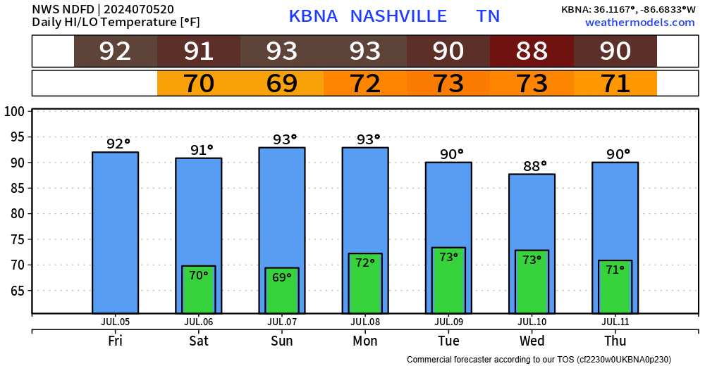
Still a relatively hot weekend, but the dewpoints have relaxed a tad – causing our heat index values to feel pretty close to what the actual air temp is.
Thanks to a high-pressure system – we won’t have any rain chances to deal with this weekend.
We won’t be able to avoid the bad humidity forever…
“70+ dew points return on Monday. (Insert little pukey face here).” – NWS Nashville AFD
The increase in moisture will bring back our chances for afternoon showers and storms for the beginning of the week.

Tropical Storm Beryl is currently over the Yucatan Peninsula, soon to emerge into the Gulf Of Mexico. Beryl is expected to make landfall somewhere on the coast of Texas as a hurricane.
Here locally, if we do see any impacts from Beryl, it would likely be the remnants of Berly bringing some rain to the area towards the middle of the week. There is still a lot of uncertainty with this, but we could be in for a wet end of the week.
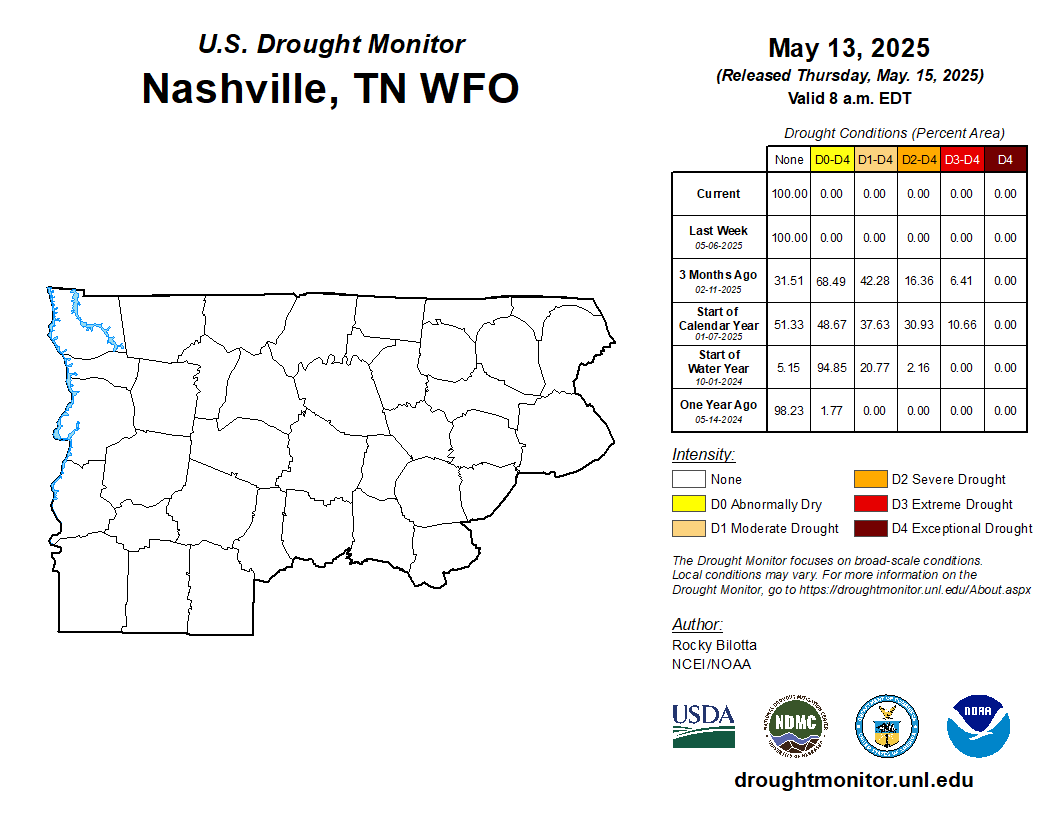
Not the worst news – we could use some rain. Places S of I-40 are in the “Abnormally Dry” category.
Categories: Featured Blog