


Spectacular weather for the first day of July.
Unfortunately, this amazing weather will be short-lived as the heat starts to turn back up tomorrow.
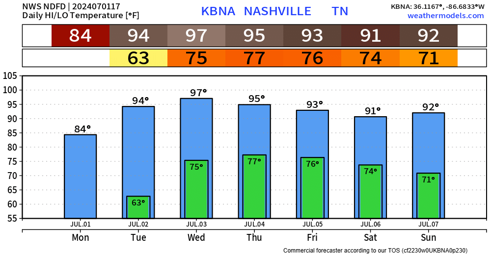
We quickly return to the 90s tomorrow and will stay there for the remainder of the week.
Dewpoints in the low 70s make a return Wednesday, which will send heat index values (aka “feels like” temps) back into the 105° – 109° range for Wednesday and the 4th.
With that much moisture in the air, the possibility for scattered showers and storms also make a return to the forecast starting Wednesday afternoon, sticking with us throughout the week.
“All of the fireworks and cookouts will not be a wash out on Thursday, but there will certainly be some scattered activity to dodge.” – NWS Nashville AFD
If we are to see some rain on the 4th, it would most likely be in the afternoon and early evening. Come sunset/firework time, most of the activity should start to quiet down. I see no reason to cancel any outdoor plans for the 4th, but not a bad idea to have a place to go if a storm rolls around.
Powerful category 4 Hurricane Beryl is churning near the Windward Islands. While no impacts are expected here locally, if you have vacation plans in the tropics – good idea to keep an eye on it.

 Log In To Facebook To Comment