
A few more isolated showers/storms are possible tonight, but I think most of us stay dry.
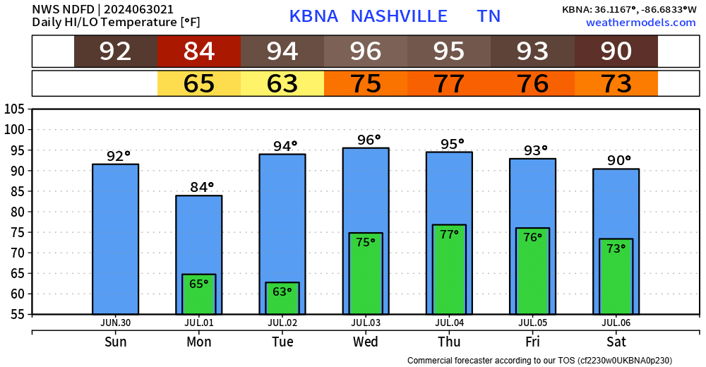
Monday will be the day of choice to get any yard work done. High temps only in the mid 80s and dewps in the mid 50s.

Unfortunately, the heat and dewpoints turn right back up Tuesday and stick around for the remainder of the week.
And yes, rain/storm chances re-enter the forecast on Thursday, just in time to make those 4th of July plans iffy.
“We will start to see slightly better chances for mainly afternoon thunderstorms Thursday and Friday as troughing develops over the Great Lakes pushing a stationary boundary to our north. Forcing still doesn’t look great in our area but should be enough to kick some stuff off.” – NWS Nashville AFD
As of right now, it appears that any afternoon pool parties and BBQs could get interrupted by a stray shower/storm. Activity should wind down as we head towards firework time, but who knows. High-res models are still way out of range. Deets will become clearer as we get closer.
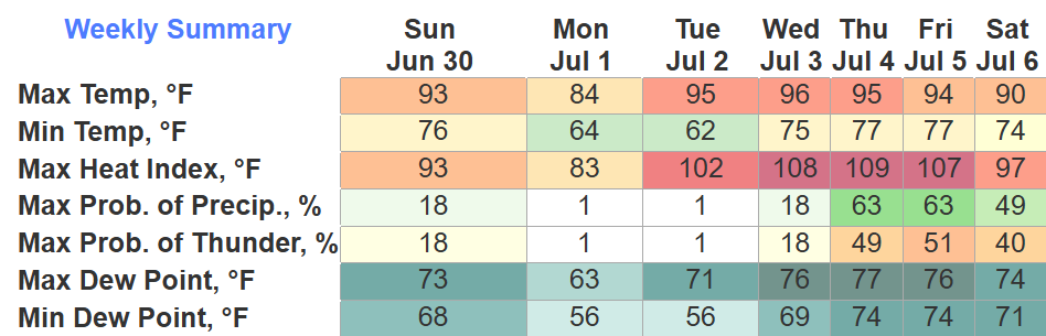
Regardless, temp + dewp combo will be h-o-t starting Wednesday.
Categories: Featured Blog