


Today is hot – tomorrow will be hotter.
Our temp/dewpoint combo today is low 90s/low 70s.
Tomorrow, we get upper 90s/mid 70s. This will send heat index values (aka “feels like” temp) into the 105° – 108° range.
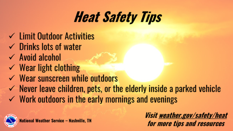
If going out and about tomorrow, especially during the noon to 8pm timeframe, try to heed some of these tips. Heat exhaustion can occur very quickly and can be dangerous if action is not taken.
The good(?) news is that we have low Wattery chances Saturday and Sunday to try help cool us off. Albeit low chances, there is a chance.
The HRRR model below shows most of the activity to our east, showing the majority of us staying dry and baking. If we do see a shower/storm, it should be brief, but could contain some heavy rain, lightning and gusty winds.
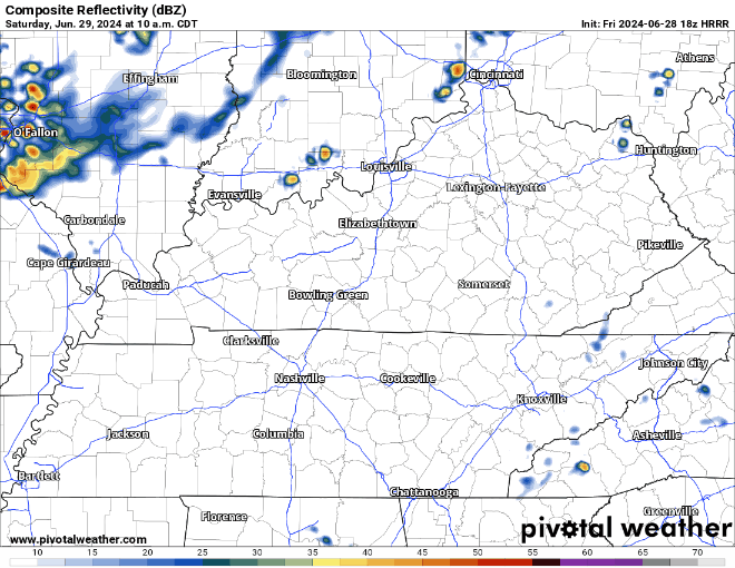
Sunday will be more of the same. I’d show the HRRR model again, but it looks pretty darn close to the gif above. Low chance of a pop-up shower/storm, heavy rain and lightning briefly possible with any storm you do see.
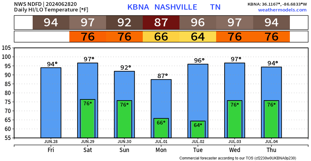
Monday will yet again be the “yardwork day of the week” with high temps only in the upper 80s and dry.
The temps and dewpoints turn right back up, just in time for the 4th. Forecast is still fuzzy, but come mid-week, pop-up chances will return. We’ll keep an eye on it.
 Log In To Facebook To Comment