
We’re still dealing with the low probability (5% chance within 25 miles) of damaging straight-line winds and hail.
Timing wise, we are still looking at a timeframe of late afternoon into the evening – shown below by the HRRR model.
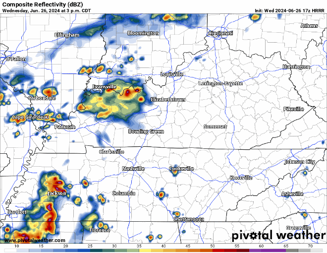
Regardless of if storms reach severe criteria, they can still contain plenty of lightning and heavy rain. If you have outdoor activities planned, keep an eye on the radar. When thunder roars, go indoors.
Maybe a few leftover showers Thursday AM, but most of the day should be dry.
Temperatures turn back up a few notches by Friday.
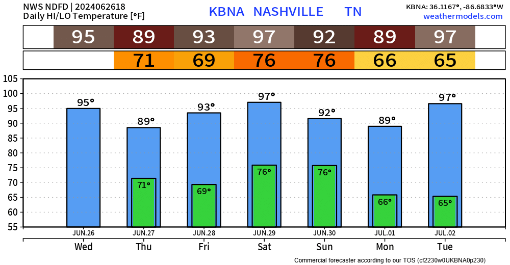
Saturday, heat index values will likely get up into the 105° – 109° range, which is Heat Advisory territory.
Pop-up shower/storm chances will also accompany us Saturday and Sunday which could help cool off temperatures. Just your typical summertime Wattery chances, most likely in the afternoon and evening.
Categories: Featured Blog