
Another very hot day is underway, thankfully the dewpoints have been relatively tame in the low to mid 60s, so heat index values are “only” hovering around 100°.
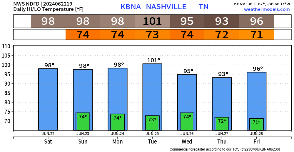
There will be no shortage of hot temperatures thru Tuesday. High temperatures in the upper 90s daily, possibly surpassing the century mark on Tuesday.
Heat index values around 100° – 105° will be possible daily in the afternoon and evening. Breaks in the shade and A/C will be needed.
Very, very low rain chances today – your chances of staying dry and hot are high.
A weak cold front will move thru the area Sunday bringing “better” chances, although still fairly low.
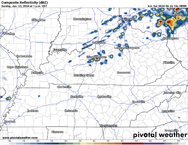
The HRRR model is unimpressed with our rain/storm chances tomorrow. If you were to see anything, the most likely timeframe will be late afternoon into the evening.
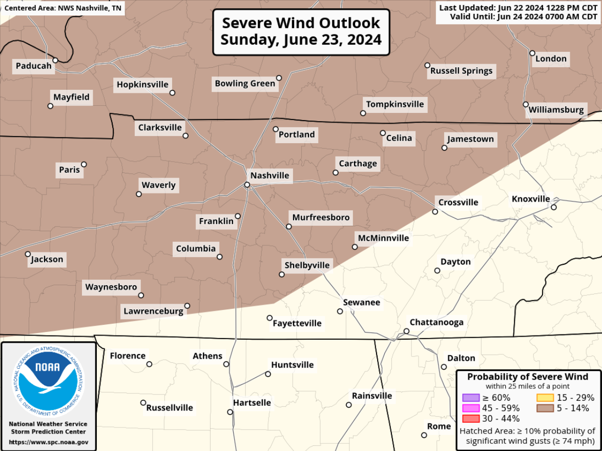
In the off chance that you see a storm, there is also a very low (5% chance within 25 miles) that you could see some damaging straight-line winds.
Drier air will be in place Monday and Tuesday, then our highest rain chances in the next 7 days come around on Wednesday. Details still fuzzy on that. Signs currently pointing to another hot and mostly dry next weekend, but a lot could change.
Categories: Featured Blog