
“Find Some Shade” was the title of this morning’s Situation Report (also known as the SitRep) issued by the NWS office in Nashville. That will be great advice for this weekend and at least the first half of next week as the heat will really let its presence be felt.
The SitRep is a great resource, it is updated at least twice a day – once in the morning and again in the afternoon. It gives a great snapshot of the forecast. If you are nerdy enough and want to check it out yourself – you can click here. “yo bro have you seen today’s sitrep?” is also a great conversation starter.
Two main topics to talk about – the heat and the rain/storm chances that will slowly increase.
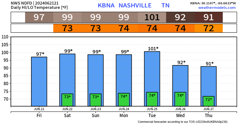
BNA got to 97° today and upper 90s will continue to dominate the forecast thru Tuesday. Can’t rule out the thermometer reaching the century mark one or two days – particularly Sunday thru Tuesday.
Dewpoints will be in the upper 60s to low 70s, leading to heat index values getting up to 105°.

If you have to be outside this weekend, be sure to take some time to cool off in the shade or A/C. Heat exhaustion is legit and it’s no joke. Check in on folks who may not have access to A/C.
The only positive news in the forecast and depending on your plans you may not see this as a positive, but rain + storm chances will increase starting Sunday.
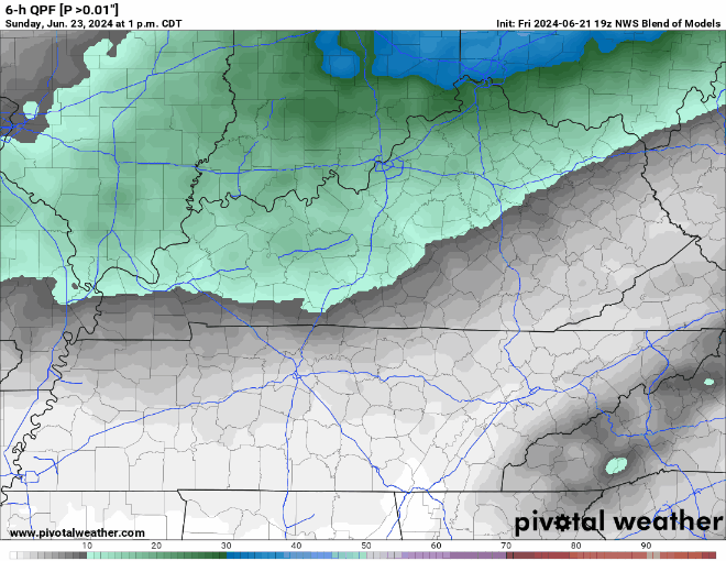
Above is a loop of probabilities of measurable rainfall, brought to you by the National Blend of Models. Timestamp is in the upper left-hand corner; the gif goes from 1pm Sunday -1pm Thursday.
- rain chances exist Sunday thru Tuesday, but are still relatively low – most of us will likely stay dry
- greater rain chances come Wednesday
- with any storm you see the chances for heavy rain, lightning and gusty winds will exist
- a strong storm cannot totally be ruled out for Sunday
- rain/storms most likely in the afternoon/evening hours
Rainfall totals thru the next 5 days look meh, generally 0.5 – 1″.
Categories: Featured Blog