


Today we’ve experienced one of, if not the hottest day thus far this year. Thankfully, dewpoints in the low 60s have kept the heat index right near the actual air temperature.
These hot temperatures aren’t going anywhere, with high temps in the 90s thru the remainder of the forecast.
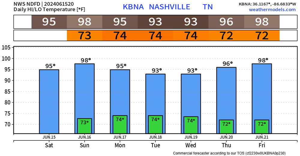
Father’s Day looks hot with a high temperature of 98°, with heat index values exceeding 100°.
However…
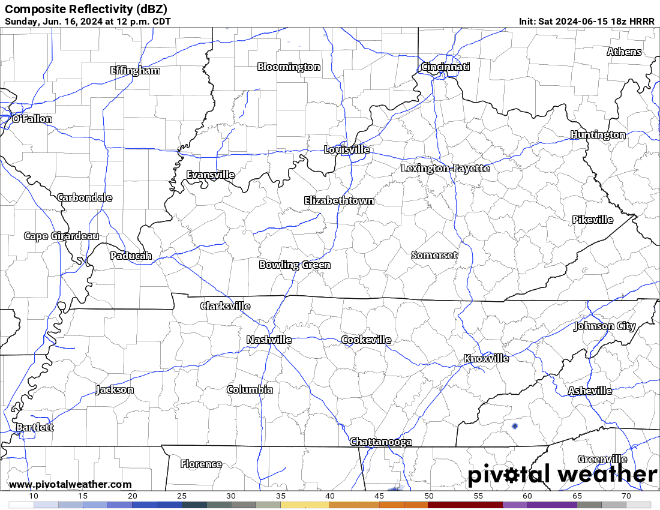
the HRRR model thinks some of us could see a shower/thunderstorm Sunday afternoon/evening. Not everyone will see rain, but if you do, can’t rule out some brief heavy rain, lightning and some gusty winds. Just something to keep in mind if you have any outdoor Father’s Day plans. No severe weather expected.
More of the same story for Monday, another scorcher, but another chance to see a shower/storm, mainly during the afternoon and evening. Not everyone will see rain, but those that do could see some heavy rain, lightning and gusty winds. Again, no severe weather expected.
Tuesday will bring the return of drier weather and that will likely be the trend thru the rest of the workweek. Dewpoints stay tame in the low to mid 60s, so heat index won’t be too much different than the actual temperature.
 Log In To Facebook To Comment