
Our “Round One” has just moved through and unfortunately, we are not done with our severe threat for today.
Despite already dealing with some legit storms, our atmosphere is expected to recover and remain primed for all modes of severe weather, with the threat lingering into the overnight hours.
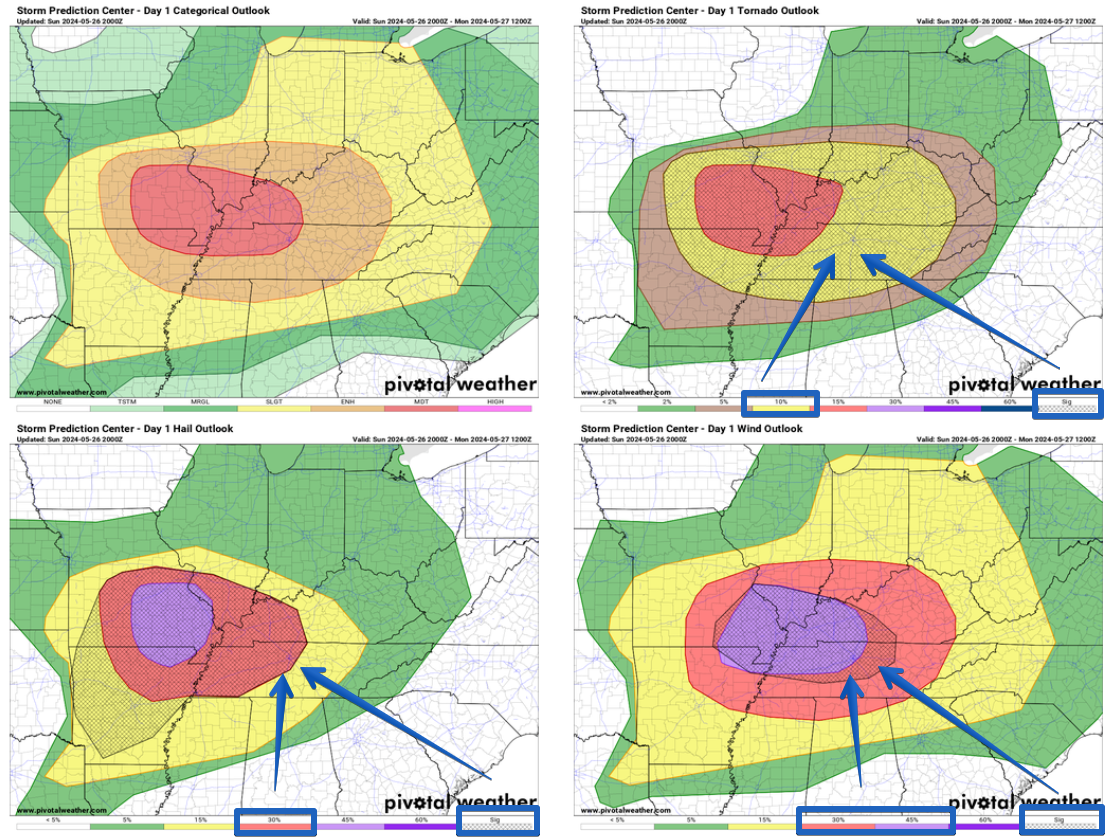
The Storm Prediction Center has increased our probabilities, with “x” probabilities within 25 miles:
- 45% chance of damaging straight-line winds (some gusts could be *80* mph+)
- 30% chance of severe hail (some could be 2″+)
- 10% chance of a tornado (one or two could be strong, EF2+)
Along with this, there is a flash flooding threat as well. If you come across a flooded roadway, turn around, don’t drown.
Even with our increased probabilities, the overall message remains the same. You need to have a way to wake up tonight if a warning is issued for you. Whether it be a NOAA Weather Radio, Wireless Emergency Alerts from your phone, a wake-me-up app such as StormWatch+, the more ways, the better. Do not rely on sirens to wake you up.
Timing:
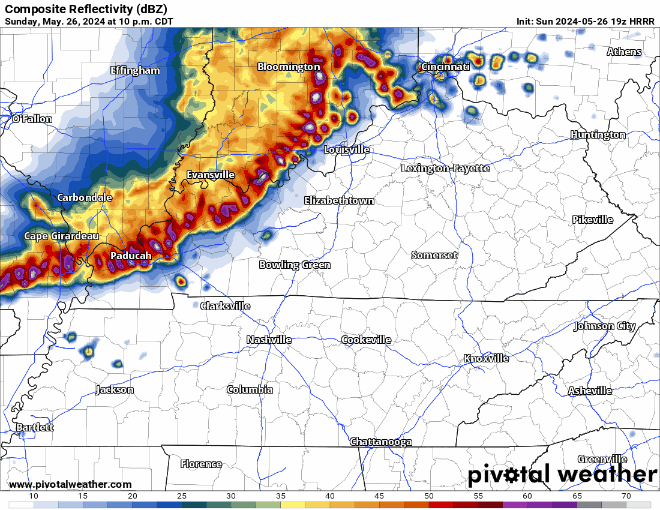
The latest HRRR model has a timeframe of 11pm – 2am for a line of potentially significant severe weather. This timeframe could change! Our main threat will be damaging straight-line winds. Wind gusts of 70 – 80 mph can cause damage similar to a weak tornado. Secure any outdoor furniture, trampolines, etc.
We’ll be up as late as we need to be, watching it and keeping y’all updated. We’ll be tweeting out updates on X/Twitter and will go live on YouTube if a warning is issued for our area (Davidson + Williamson Co.). Have a plan and know where to go if a warning is issued for you. No need to panic, but a great time to be prepared.
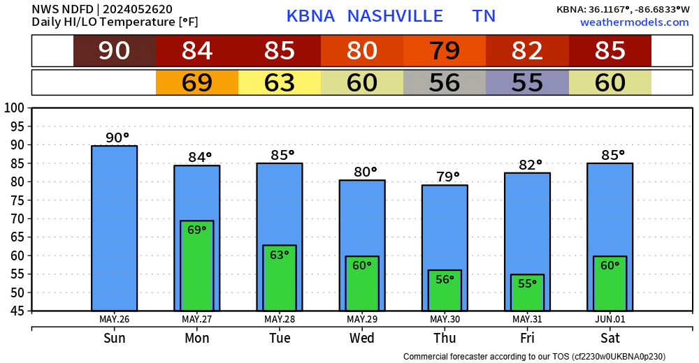
Rain should be gone by sunrise Monday and we’ll be left with a couple of dry and warm days. More info after storms move through tonight.
Categories: Featured Blog
Kudos to you all from friends who were driving from Alabama to Dayton earlier today.
“ I sent Lindsey and Markus NashSevereWX…
They said:
Thanks for sending the weather station to follow, it gave us a heads up which got us off the highway
“…when we were 5 miles from Franklin the supercell was right over I-65. We pulled into a gas station and a cop recommended driving 10 miles back south so we did, grabbed food and by the time we came back it was sunny again and now we will miss the bad weather near Louisville 😊”
Thanks for making their trip easier and safer!