
BNA ended up getting all the way to 91°, just one degree shy of the daily record high. First time seeing temperatures in the 90s since September 26th of last year. Cicadas love it.
We should stay dry today, you’d be very unlucky to see a brief shower.
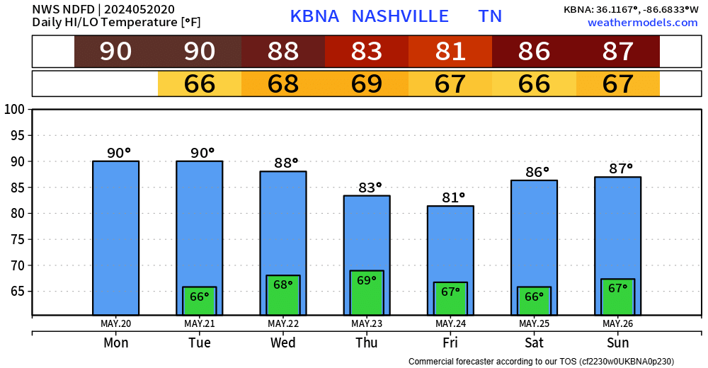
Tuesday and Wednesday will have two more chances at hitting the 90° mark. Bleh.
Legit rain chances hold until Wednesday.
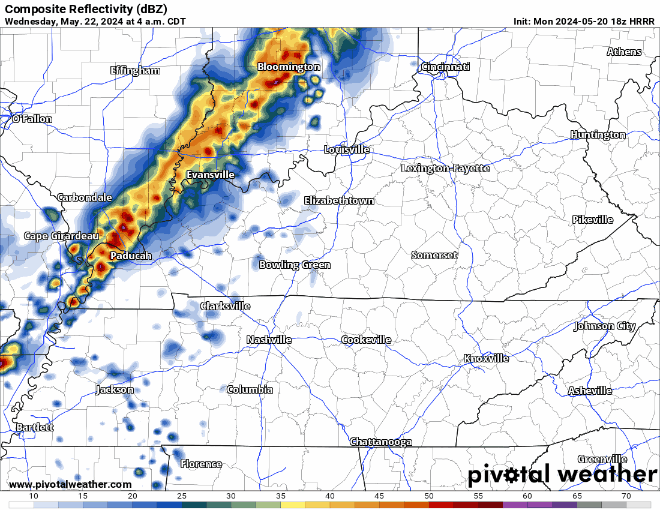
The HRRR model thinks we see some showers Wednesday morning but keeps the storms in NW Tennessee thru at least the afternoon. We are not included in any severe probabilities, those are to our NW.
“Thursday through Memorial Day looks like multiple rounds of showers and thunderstorms as Wednesday night’s weak front hangs around the region. I don’t see one day with a particular stronger storm threat over the next…” – NWS Nashville
Not the greatest news for the upcoming holiday weekend, but I doubt we see rain every single day. Rainfall totals could start adding up by the end of the week which could cause a few rivers/streams to get a little high. We’ll keep an eye on them. More specific deets to come in the following days.
Categories: Featured Blog