
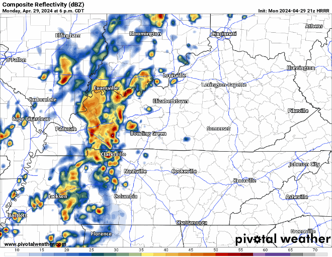
Activity should ramp up over the next couple hours, bringing in some showers and sub-severe storms. Maybe a few rumbles of thunder and some gusty winds, but nothing of concern. HRRR model below shows the story.
We should be mostly rain-free by sunrise, with only a few leftovers come Tuesday morning.
Rest of Tuesday thru Thursday night should be rain-free. Temps will get up into the mid to upper 80s come Wednesday and Thursday.
“Thursday still looks like the warmest and latest NBM probs show the chance of getting to 90 degrees at about 70% for BNA.” – NWS Nashville
If we do get to 90°, it’ll tie the daily high record for May 2, set back in 1901.
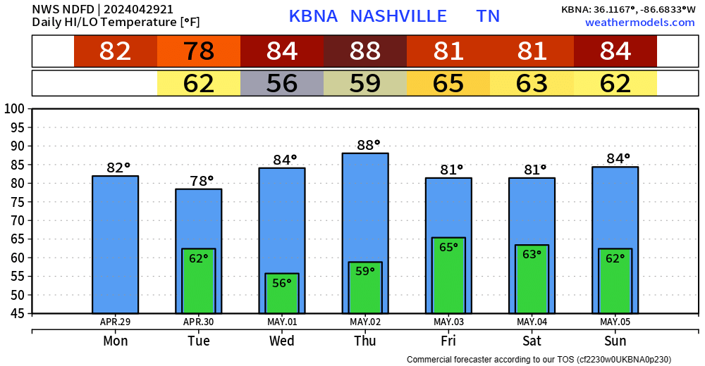
Rain chances return Friday morning sticking thru around Saturday morning. Looks like we’ll manage to be dry Saturday afternoon thru Sunday night? (question mark for uncertainty), before more rain kicks off our new week. Thankfully, no severe weather chances are currently in the forecast. Although the cicadas possibly emerging isn’t great news.
Categories: Featured Blog