
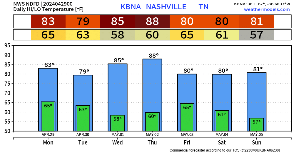
High temperatures will get into the low 80s Monday before some rain/storm chances arrive.
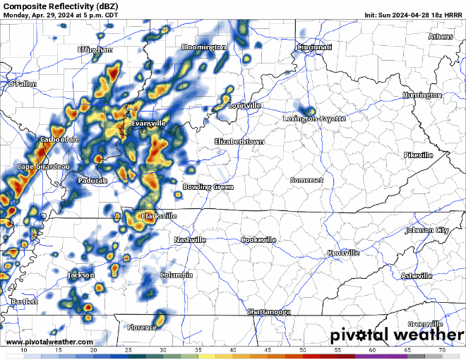
HRRR model (above) has a rough ETA of 7-9 pm Monday. A few rumbles of thunder are possible, but no severe weather is expected. Majority of the activity should be to our east by rush hour Tuesday morning.
About 1 – 1.5″ of rain expected thru Tuesday morning. Not expecting any flooding issues.

We’ll get a break from the rain the rest of Tuesday thru Friday when more rain chances enter the area. A lot of uncertainty with the timing, but no severe weather is in the forecast as of right now.
While we get a break from the rain Wednesday + Thursday, high temperatures will be in the mid to upper 80s. Thursday we could make a run at the 90° mark, which if we were to get there, we would tie a 123-year record per NWS Nashville.
Categories: Featured Blog