


Storms in West TN will slowly make their way over tonight. Thankfully, they should lose their steam and we are not expecting any severe weather tonight.
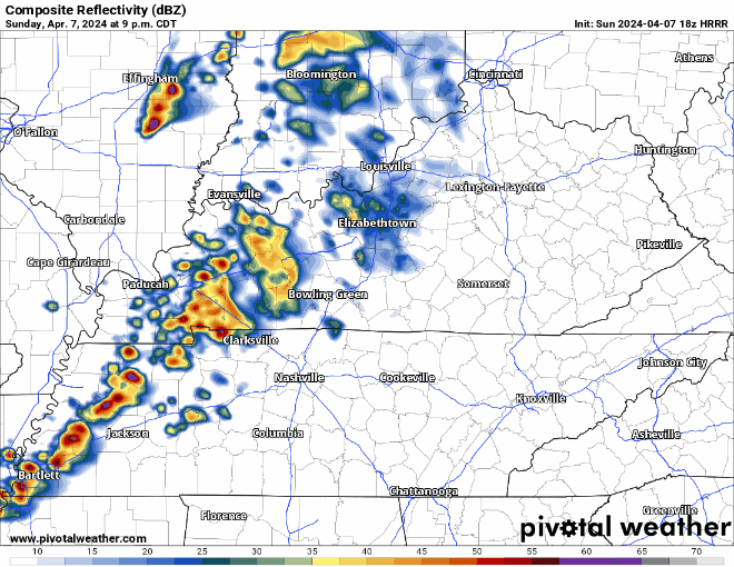
HRRR model (above) has an ETA of around midnight tonight. You may hear a rumble of thunder, but no worries. Rain should exit before Monday AM rush hour.
Eclipse Cloud Cover Guesses
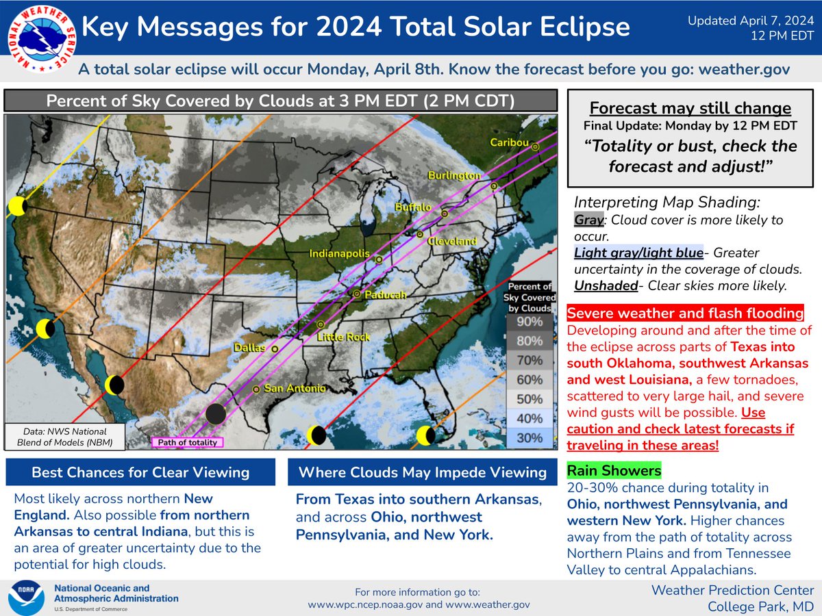
Best close viewing for totality looks like Arkansas into Illinois.
Here locally, things look a little iffy.
“Unfortunately, the cloudiness will ramp up tonight and Monday. All the eclipse viewers will have to play dodge ball with the cloudiness. Good luck to all.” – NWS Nashville
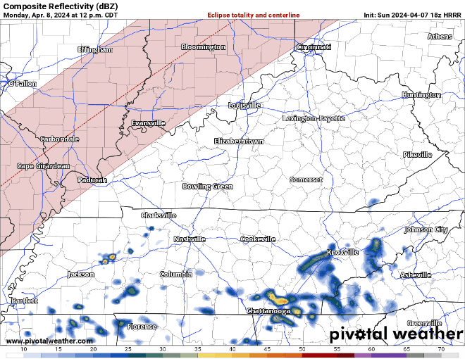
Along with clouds, we’ll also be dodging scattered showers/t-storms Monday afternoon thru evening. No severe weather concerns here.
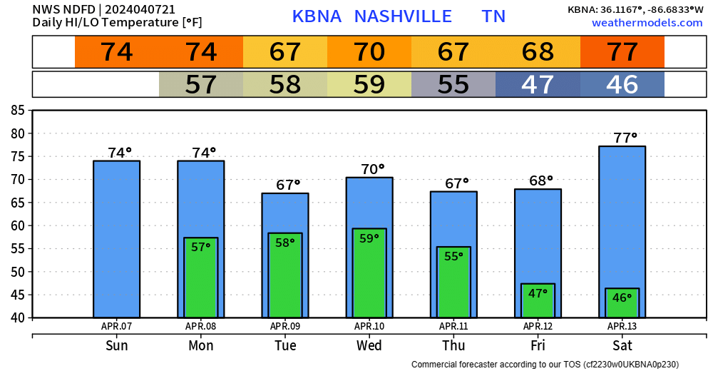
Rain/thunderstorm chances will continue thru Thursday. 3-4 inches of rain are expected thru Thursday. Specific ETAs are hard to nail down due to the isolated nature. Severe weather chances are expected to stay to our south. Thankfully it should be spread out enough to where we aren’t dealing with any flooding concerns.
Good news is Friday and Saturday look warm and dry.
 Log In To Facebook To Comment