

Another December day that doesn’t feel like December.
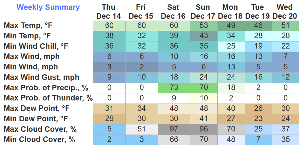
Plenty of sun propelled high temperatures into the low 60s. Temps will fall down into the low 30s tonight.
Friday will be a copy and paste of what we had with today.
Saturday, clouds will increase throughout the day as a cold front approaches.
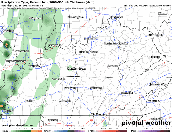
The EURO (above) shows said cold front bringing some showers along with it. This particular run shows rain chances increasing Saturday afternoon, lasting thru the early hours of Sunday morning. This timing could very easily change. No severe weather is in the forecast.
Both the GFS and EURO model currently agree that the rain will move out in time for Titans’ game.
“Depending on how much wrap-around moisture we experience…precipitation might end as a wintry mix — or just plain snow — Monday afternoon and evening, mainly along the Cumberland Plateau. But we aren’t expecting any accumulation.”
– NWS Nashville Afternoon AFD
AKA we could get some rain showers Monday afternoon, but if you hear any talk of snow, it’s not for us, just the Plateau.
Speaking of, we still don’t have any snow in the forecast.
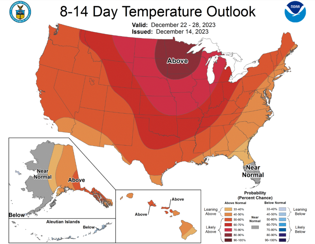
The 8-14 day temp outlook shows above normal temperatures for us. All signs point to a mild X-mas.
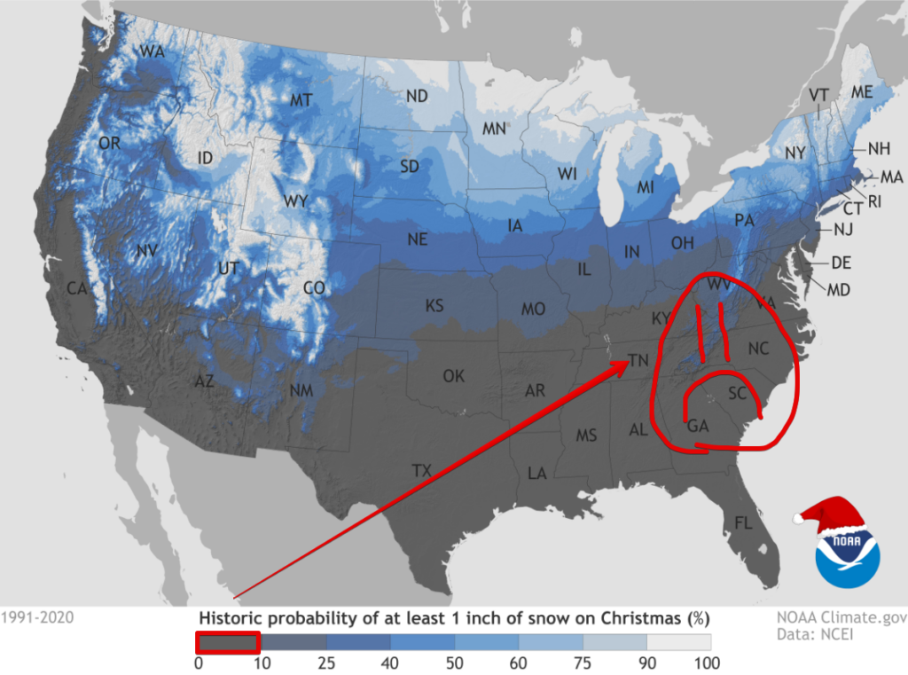
Not that we normally have much of a chance at a White Christmas…
Quick References:
Weather changes constantly.
Follow @NashSevereWx on Twitter for any changes to this forecast.
Live coverage during tornado and severe thunderstorm warnings:

Look good.
Support the mission.

We are 100% community supported. No ads. No subscription fees. Keep it free for everyone.


Categories: Forecast Blogs (Legacy)
You must be logged in to post a comment.