


Solid line of good soaking rain that came thru this morning. A majority of us should stay dry the rest of the day, but there is a chance.
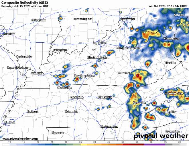
HRRR model (above) shows a cluster of showers/storms moving down I-24 this evening. Timing looks a bit unfortunate as it could impact Queen B and other outdoor activities. Lightning and heavy rain would be possible with this.
However, not all models think it’ll rain.
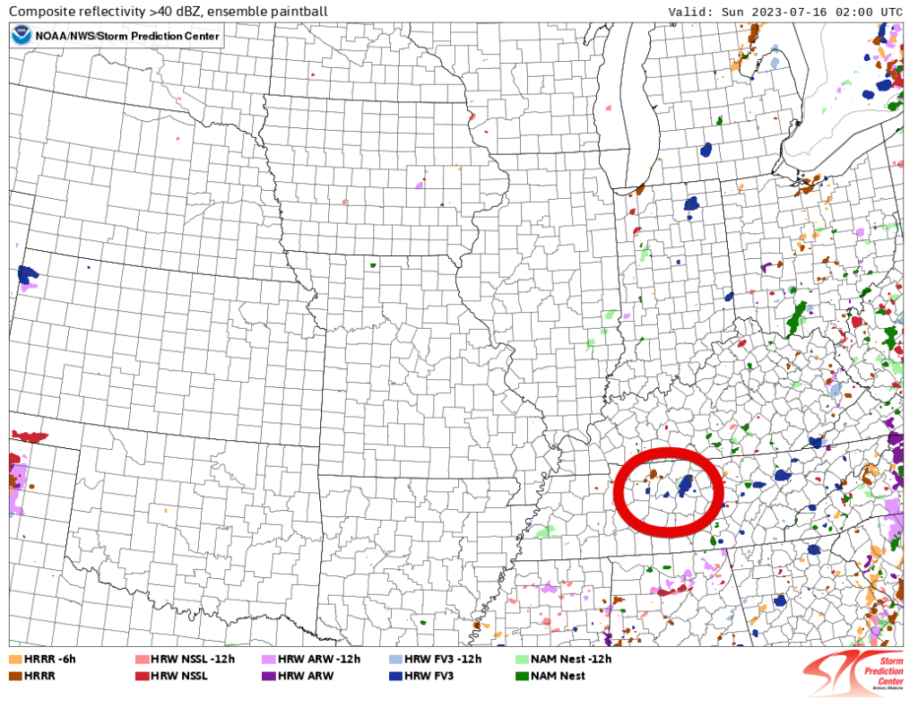
Here is an ensemble of models, often referred to as the paintball ensemble because it looks like the map got caught up in a paintball match.
There are ten models represented, each one being displayed by a different color. This particular image shows what ten different models think the radar will look like at 9pm tonight. Out of the ten models, only two, maybe three think we see any rain tonight. This is encouraging, but it’ll be important to stay connected and be flexible.
If going out tonight, have a poncho and patience ready. If there is a delay, I do not think it’ll be a long one. No severe weather expected even if it does rain.
Sunday looks dry before Wattery chances return Monday and stick around the rest of the week.
Wednesday and Thursday a Heat Advisory may be needed for heat index values around 105° with actual temps in the upper 90’s. Fingers crossed the Wattery can cool us off cause those temps are gross.

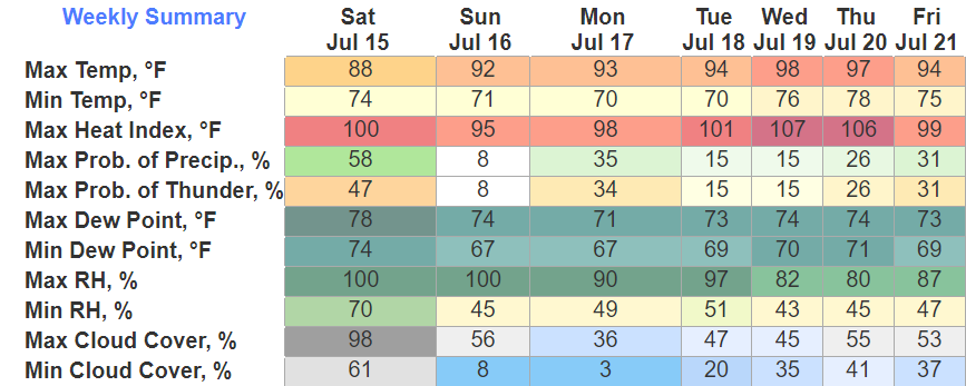
Quick References:
Weather changes constantly.
Follow @NashSevereWx on Twitter for any changes to this forecast.
Live coverage during tornado and severe thunderstorm warnings:

Look good.
Support the mission.

We are 100% community supported. No ads. No subscription fees. Keep it free for everyone.


 Log In To Facebook To Comment