


A bit of a tough forecast the next few days. Daily rain chances, impossible to know exactly when and where.
Storm Prediction Center has places west of I-65 outlooked with a 5% chance of damaging straight-line winds within 25 miles today. This is of course, dependent on if storms actually pop-up. HRRR and NAM3k models both show nothing today. Models are guidance, not gospel, so it’ll be important to stay connected if you have outdoor plans.
Thursday will be much of the same story.
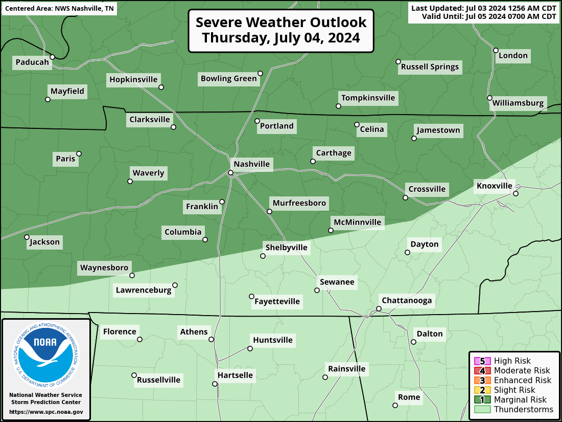
The SPC has both counties outlooked with a 5% chance of damaging straight-line winds and/or severe hail within 25 miles for tomorrow.
Similar to today, HRRR model doesn’t show much activity for us. Again, it’ll be important to stay connected. Models can be wrong and you do not want to be caught outside in a storm.
Friday and Saturday will be alike. We are currently not outlooked for severe weather either day. However, rain/storm chances will stick around. Timing is very fuzzy right now. Most likely in the afternoon and evening. Fingers crossed any rain will get outta here before Queen B.

Rain chances and heat index values around 100° stick with us thru at least early next week.
Quick References:
Weather changes constantly.
Follow @NashSevereWx on Twitter for any changes to this forecast.
Live coverage during tornado and severe thunderstorm warnings:

Look good.
Support the mission.

We are 100% community supported. No ads. No subscription fees. Keep it free for everyone.


 Log In To Facebook To Comment