


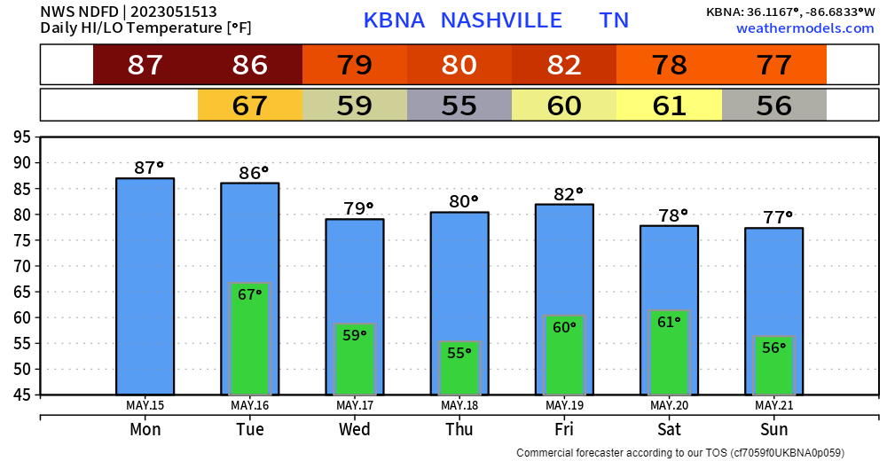
The next two afternoons and evenings will carry rain chances. Pretty typical for this time of the year.
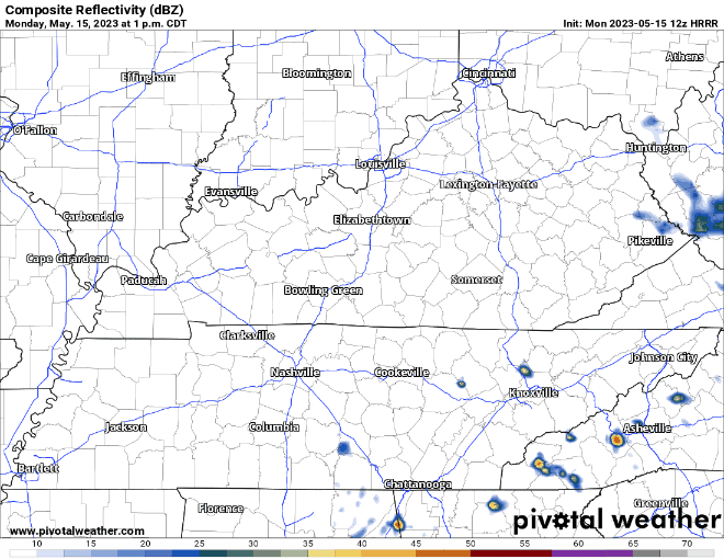
The HRRR model (above) thinks we dodge most of the activity today. It’s hard to put a lot of confidence in that, but it’s a good sign I suppose. Any storm that does pop up today could contain lightning, heavy rain, gusty winds and some small hail. When thunder roars, go indoors.
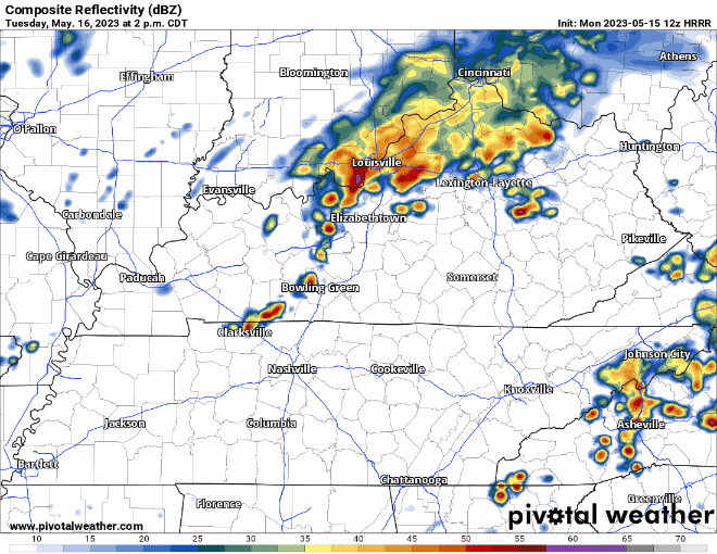
Fairly similar setup for Tuesday, HRRR model (above) suggests a line of storms quickly moving through at some point in the afternoon/evening. Again, any storm could contain lightning, heavy rain, gusty winds, and perhaps some small hail.
If you are looking for rain-free days, Wednesday and Thursday have your name written all over them. We also will “cool” down a tad, which is just a bonus.
This “rain-free day” talk will be short-lived. Rain chances will return Friday and stick around for the weekend, great timing (not). It’s still too early to say with any sort of confidence any sort of timing on rain. Good news is that it doesn’t look like a complete washout. Also, it won’t be blistering hot. Always good to look on the bright side I reckon. More details throughout the week as confidence increases.

Quick References:
Weather changes constantly.
Follow @NashSevereWx on Twitter for any changes to this forecast.
Live coverage during tornado and severe thunderstorm warnings:

Look good.
Support the mission.

We are 100% community supported. No ads. No subscription fees. Keep it free for everyone.


 Log In To Facebook To Comment