


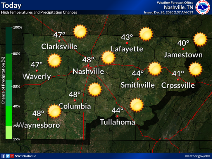
It was definitely a chilly morning when some of you woke up:
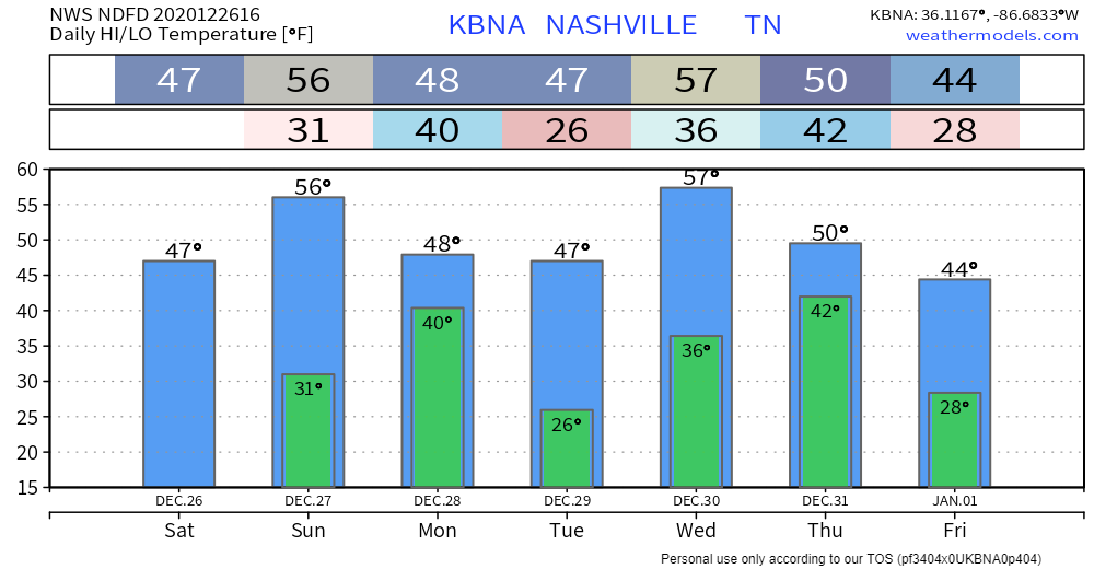
We have sunny skies and temps warming up through the afternoon, highs around 48°.
Clear conditions continue overnight, lows near 31°.
Not Much Happening Through Sunday Afternoon
Sunshine will continue to stick around, which helps temperatures to continue to rise.
Highs will be in the mid 50s.
Slight Chance of Rain Sunday Night
Another cold front will be coming through the area, bringing some showers with it.
Light showers could begin to pop up ahead of the main line after midnight. These showers will begin to quickly move through the area, with models showing it entering around 3 am and exiting after 4 am. Almost none of us will notice.
This won’t be a washout: between a hundredth and a tenth of an inch of rain is expected.
Looking Ahead
Some clouds will be lingering on Monday and Tuesday, but for the most part, sunny skies.

Wednesday
Our next big rain event comes Wednesday. No severe weather is currently expected, but here’s what the National Weather Service has to say about this system:
Both solutions show a strong low level jet that will transport plenty of moisture into the area which could produce heavy rain that could cause some minor issues. At this point, not seeing much in the way of instability so thunder was left out. As the system exits the area, we could see a brief changeover to snow, but don’t expect a big weather trouble maker.
NWS Area Forecast Discussion
Much of the rain will come Wednesday night into Thursday. By 6 pm Thursday, the Weather Prediction Center thinks we’ll see significant rainfall. We will be keeping an eye out for flooding potential, if this forecast continues.
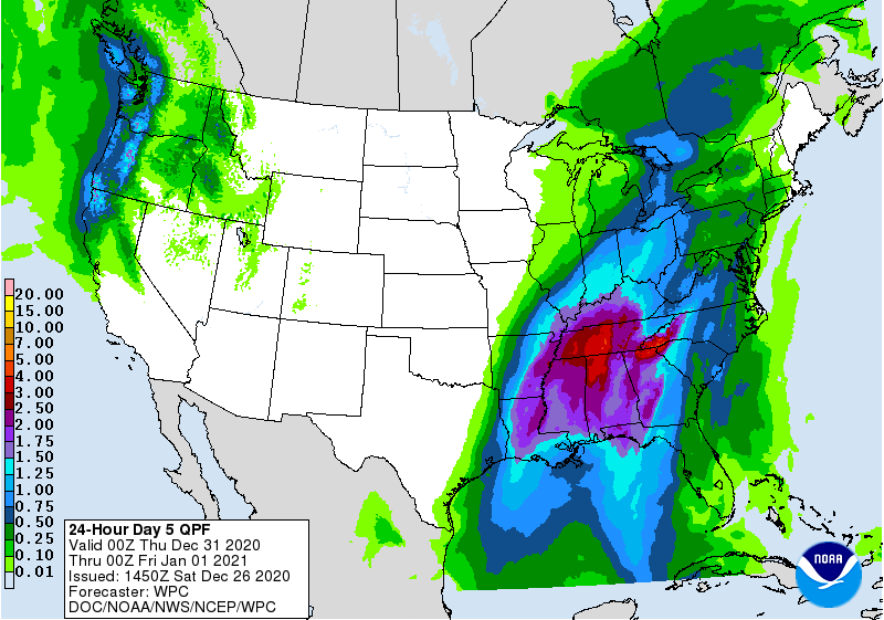
This event is still several days out, so things could change.
 Log In To Facebook To Comment