


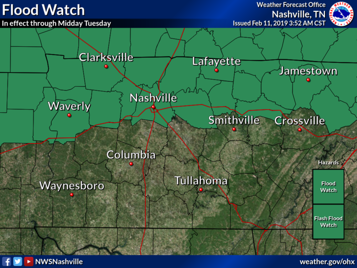
Flood Watch: A Flood Watch remains in effect for Davidson County through midday Tuesday.
Key Takeaways:
- An additional 2 to 3 inches with locally higher amounts of rainfall is expected over already saturated ground. This will cause flooding issues across the watch area.
- Street flooding will be a big hazard for travelers. Low lying areas and poor drainage areas will be at risk for flash flooding. Also, watch for flooding along small streams and rivers.
How Much More Rain?
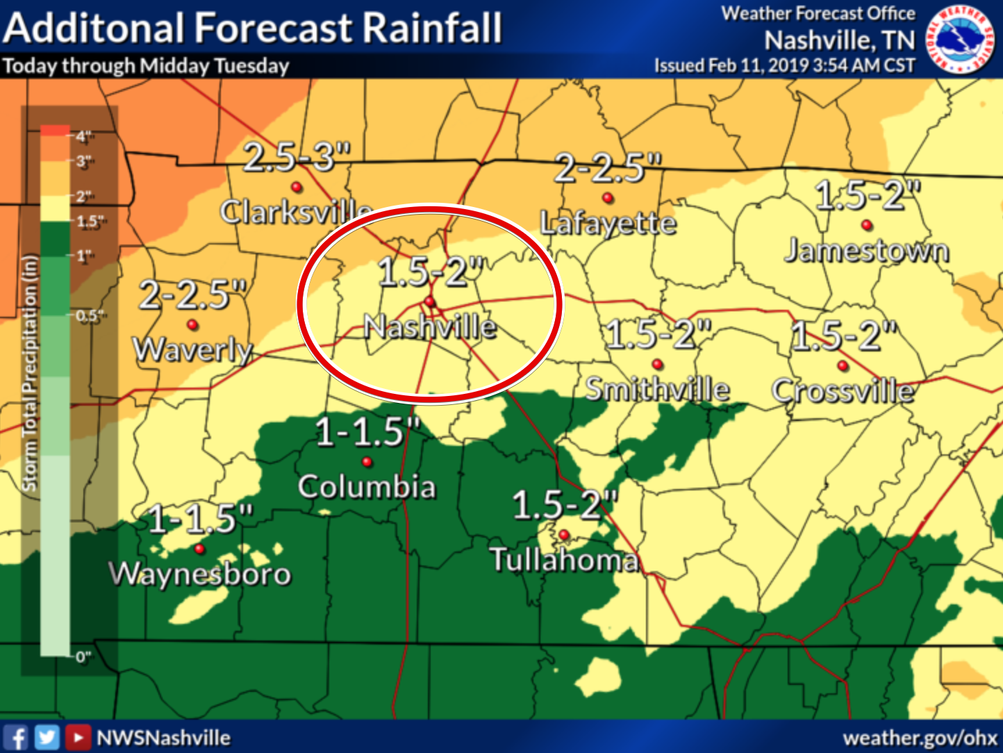
The National Weather Service in Nashville has both Williamson and Davidson Counties in the 1.5-2″ range. This is through midday tomorrow. More expected north and northwest of us.
Timing
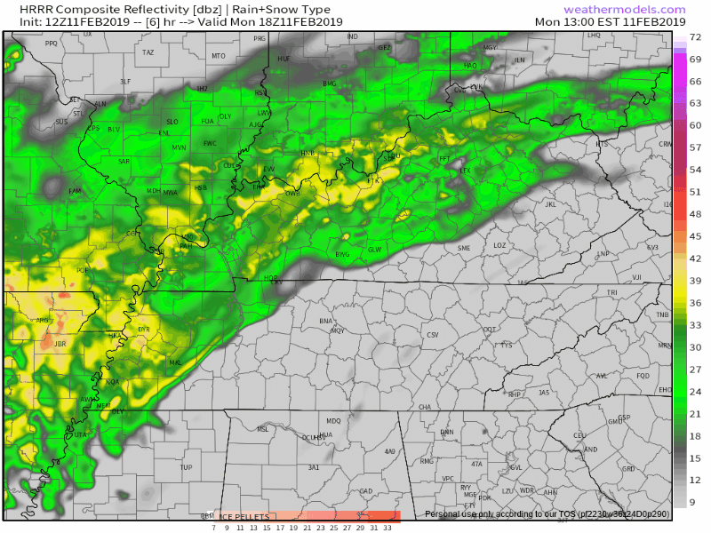
Below is the HRRR model running noon Monday through noon Tuesday. Seems like the most likely scenario given the moisture availability.
Another model, the NAM3, shows more rain for a longer period of time.
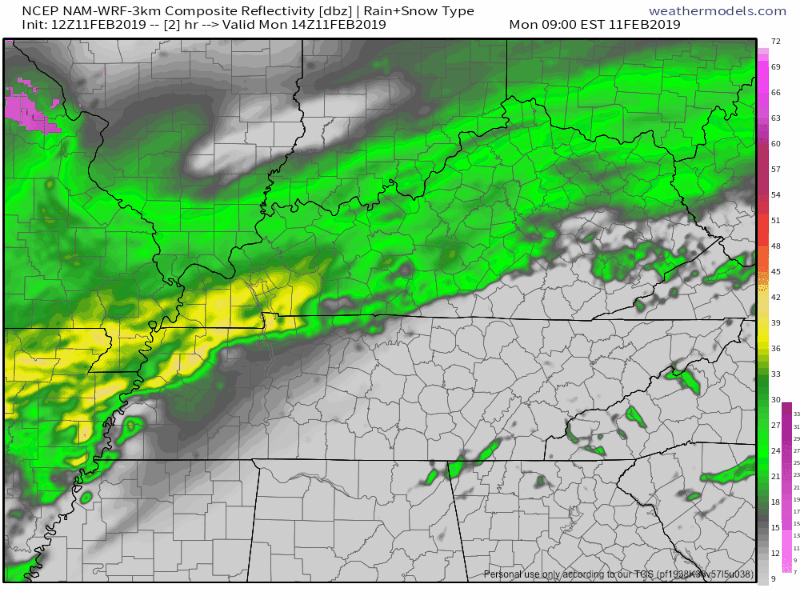
Both models show the heaviest rain arriving Tuesday morning. Embedded in this heavy rain should be a few thunderstorms, but nothing severe is expected.
Drying Out
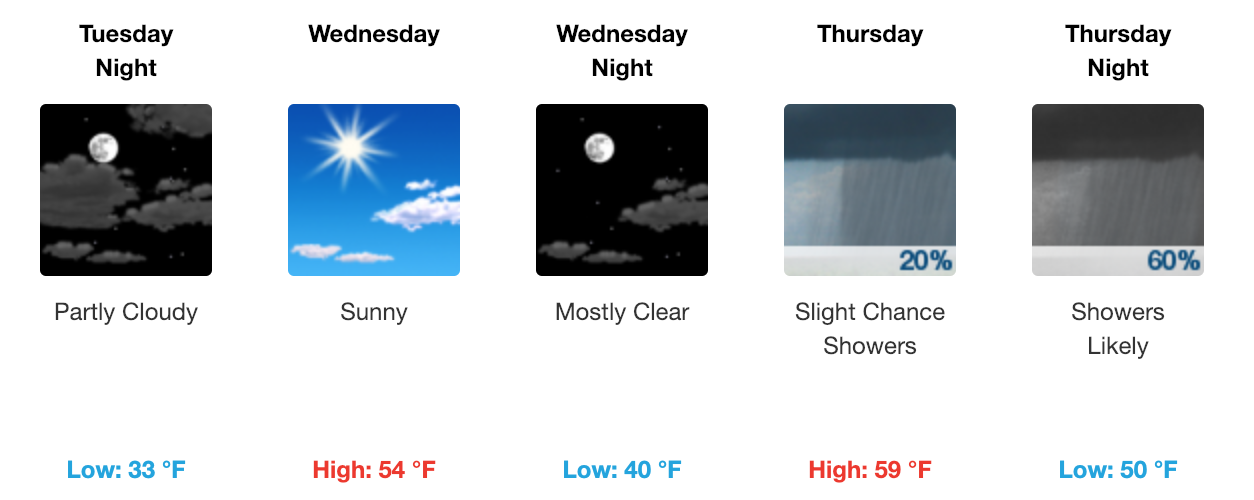
After the front moves through on Tuesday and clears out the rain, we will have a dry 36-48 hours. Overnight lows will be steadily increasing through Tuesday with high temperatures in the upper 50s.
More rain by week’s end. Here is what NWS Nashville had to say about it:
The next front moves in Thursday night making Thursday night and Friday soggy once again. There could be some rumbles of thunder on Friday for the higher elevations. As this system moves out Friday night models plummet the temperatures which means the forecast area will be flirting with the “s” word/snow. Don’t expect any accumulations.
Check back here and on Twitter, @NashSevereWx, for any warnings and advisories that may come out and updates throughout the day.

 Log In To Facebook To Comment